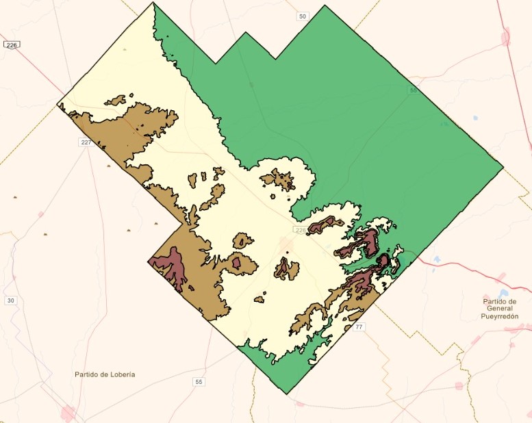
Alturas
La capa de alturas constituye una forma de representación del relieve topográfico (altimetría) basado en las curvas de nivel del partido.
Simple
- Date (Publication)
- 2023-06-05T14:02:00
- Status
- Completed
- Maintenance and update frequency
- As needed
- Theme
-
-
Altimetria
-
- Access constraints
- Copyright
- Spatial representation type
- Vector
- Denominator
- 10000
- Metadata language
- Spanish; Castilian
- Character set
- UTF8
- Begin date
- 2020-01-05
- End date
- 2023-06-05
N
S
E
W
))
- Supplemental Information
-
Esta plantilla fue adaptada por IDEBA basada en la plantilla creada por IDERA.
- Reference system identifier
- EPSG 5347
- OnLine resource
-
balcarce:Alturas
(
OGC:WMS-1.1.1-http-get-capabilities
)
Alturas
- OnLine resource
-
balcarce:Alturas
(
OGC:WFS-1.0.0-http-get-capabilities
)
Alturas
- File identifier
- dc71f658-b620-4785-8e34-e013109a8a13 XML
- Metadata language
- Spanish; Castilian
- Character set
- UTF8
- Date stamp
- 2023-07-12T10:20:04
- Metadata standard name
-
ISO 19115:2003/19139
- Metadata standard version
-
1.0
Metadata author
No information provided.
Overviews

Spatial extent
N
S
E
W
))
Provided by

Associated resources
Not available
 Catálogo de metadatos